Student Research Assistants
My student mentees are an integral part of my research. From small-scale projects that can be completed in a semester, to ongoing multi-year efforts – mentoring students both prepares the next generation of scientists for careers in an out of academia, as well as broadens the scope and impact of my own work. Below you can read a little about some of the projects my mentees work on.
Beaver Dam Catalogue
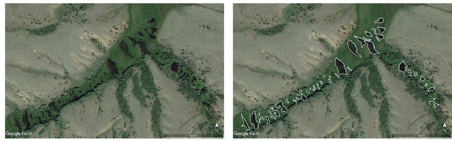
Beaver dams are pretty much everywhere in North America – from the northern edge of Mexico up to the Arctic Circle, from east coast to west coast, and everywhere in between. Many beavers dams are large enough to be identified in satellite and aerial imagery. An ongoing project that all of my student research assistants are involved in is mapping out all the beaver dams in various study areas across the United States using Google Earth. This project is a designed as an introduction to data collection, using Google Earth and Earth Engine for scientific research, basics of GIS, and dealing with uncertainty. To date, my students and I have mapped out thousands beaver dams in California, Colorado, Wyoming, Oregon, Washington, Arizona, New Mexico, Idaho, Montana, Utah, Minnesota, and eastern Canada. We have additional field sites all over North American currently on our “to-map” list as well.
Surface Water Storage in Beaver Ponds
What’s the point in mapping all these beaver ponds out? There is a lot of valuable information that can be gleaned from the data, and one project that spun out of the dam catalogue work was whether or not the total surface water storage in beaver ponds could be estimated in a given landscape from just the remotely sensed data.

Beavers and Wildfire
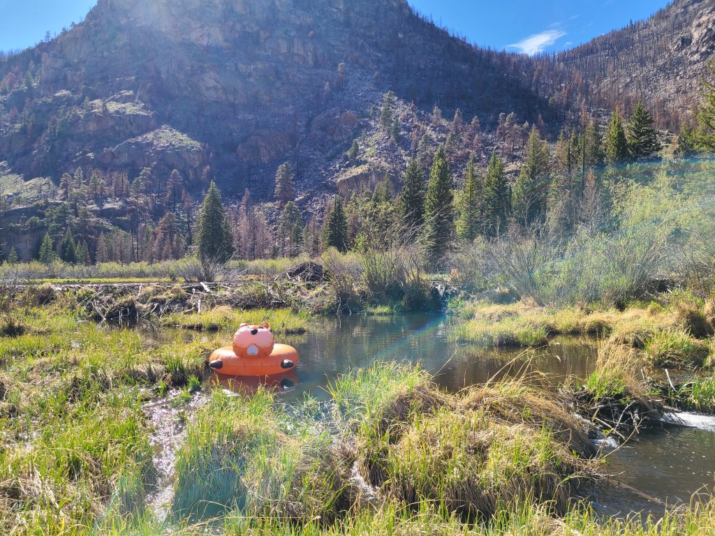
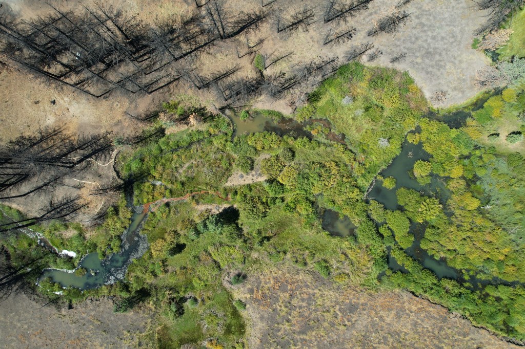
Beavers are widely known as “nature’s engineers,” but recent news suggests they play another important role in land management: firefighting. Most fire models used in land management take a spatially gridded fuel file as one of their inputs, which are often derived from satellite-acquired land cover information. However, this landcover data rarely classifies beaver ponds as open water, and due to the relatively small, patchy nature of beaver-created wetlands the increased moisture content in soil and fuels nearby beaver ponds is also overlooked. We are scraping the existing data – including beaver-occupancy records and models, historical fire perimeters, satellite images, and aerial photography – to model and quantify the impact that beaver damming has on wildfire spread via increased water storage in the root zone.
Beavers, Droughts, and Deserts
In my 2018 Ecohydrology paper, I showed that beaver damming had the ability to buffer riparian ecosystems against the effects of both short- and long-term droughts. That study only considered one area in Nevada: Susie and Maggie Creeks near Carlin, NV. The next step in that project is to repeat the study at several more study areas across the American west and to more explicitly consider the role of beaver-dug channels. This project provides an opportunity for students to get experience with hydrologic modeling in R, ecologic landscape assessment using FRAGSTATS, data collection in Google Earth and ESRI products or QGIS, and data processing and visualization using Python.
Beaver Management Policy and Best Practices
Beavers are gaining popularity around the world as a partner in climate change adaptation and mitigation work. But what is the best way to work with them? Is what is best for people the same as what is best for people? How do we balance human, ecological, hydrological, and economic considerations when we work with beavers? My students and I are exploring these questions through a combination of literature review, meta analyses, and experimental research.